• Sign Up
  • Login
  • Lost Password?

  • Pay Membership Dues
Events/Latest News: CARILEC CE Journal Nov 2021 | CARILEC CE Journal May 2021 | Submit an Article | See All Our Journals |
CARILEC
  • Home
  • About Us
    • Overview
    • Governance
    • Our Members
    • ByeLaws
    • Contact us
  • Services
  • Resources and Media
    • Advertising Brochure
    • Guidelines and Manuals
    • Publications
      • Caribbean Electric Industry Journal
      • Annual Reports
      • Tariff Surveys
      • White & Position Papers
      • Fact Brochure
    • News
  • Energy Communities
    • CDAP
    • CAREEP
    • CARILEC Renewable Energy Community
    • Women in Renewable Energy (WIRE NETWORK)
  • Careers & Procurement
  • Events
    • Upcoming Events
    • Become a Sponsor
    • Past events

Geographic Information Systems Symposium

  • Home
  • >> Networking>>
  • Geographic Information Systems Symposium

Click here ....

Event Schedule Event Sponsors Event Speakers
CARILEC GEOGRAPHIC INFORMATION SYSTEMS SYMPOSIUM
Register
Event Brochure
Agenda

ABOUT THIS EVENT

Geographic Information Systems (GIS) is a framework which enables the capture and analysis of spatial and geographical data.  This analysis permits governments, meteorological services, regulatory bodies, and corporations to name a few, to make decisions based on a comparison of locational information.  Electric utilities and energy-affiliated companies are no exception to the wide-ranging benefits of GIS.  With the increase in the effects of global warming and the looming signs of climate change becoming ever more present, GIS has become a critical asset in asset management, resource mobilisation and overall decision-making at electric utilities.

The 2020 Atlantic Hurricane Season has been dubbed as the most active season on record.  Over thirty (30) storms developed during the season; a staggering number to say the least.  Moreover, weather experts are predicting that the 2021 Atlantic Hurricane Season will be just as active, if not worse.  Consequently, many electric utilities and disaster management organisations have since been implementing GIS into their operational systems, to assist them in the management of disaster recovery, with a high level of precision and accuracy.  GIS has facilitated electric utilities’ quick turnaround in the restoration of power after a storm, having provided the exact location of the outages and intricate details of the topography, vegetation, and population density.

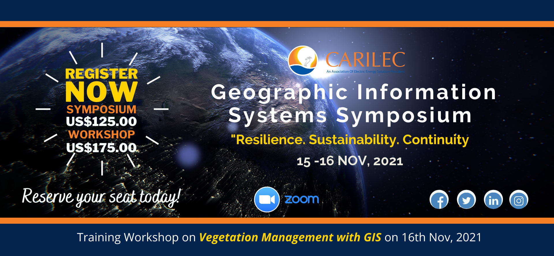
Given the increased use of GIS by electric utilities, CARILEC has decided to focus its symposium on the use of GIS in disaster management and restoration, under the theme, “Resilience. Sustainability. Continuity.”.  The symposium will feature virtual presentations from electric utilities which have successfully utilised GIS in disaster and power restoration efforts, as well as in their everyday operations.  Armed with actionable intelligence from the use of GIS, attendees will be able to use data to make decisions in a timely manner, with the desired outcomes.  Come and receive first-hand information on the benefits and multiple uses of GIS in the electric utilities and energy sector! Reserve your space today!

For further information contact our Marketing and Member Services Department at events@carilec.org.  This symposium is targeted towards CEOs, senior utility personnel, disaster coordinators, occupational health and safety officers, engineers and technical specialists/analysts of electricity and energy affiliated organisations.

 *All-access pass for members.

*All-access pass for non-members excluding member exclusive events.

Who will attend

  • GIS Professionals
  • GIS Technicians

EVENT AGENDA

  • Monday Nov 15 Event Day 1
  • Tuesday Nov 16 Event Day 2
  • GIS Opening Ceremony 9:00 a.m - 9:15 a.m
  • Presentations
3 mins
5 mins
9:15 a.m - 9:50 a.m
9:50 a.m – 10:25 a.m
10:25 a.m – 10:40 a.m
10:40 a.m – 11:10 a.m
11:10 a.m – 11:45 a.m
11:45 a.m – 12:20 p.m
12:20 p.m – 1:20 p.m
1:20 p.m – 1:50 p.m
1:50 p.m – 2:25 p.m
2:25 p.m – 2:55 p.m
2:55 p.m - 3:05 p.m
3:05 p.m – 4:35 p.m
  • Vegetation Management
Sponsor this Event

EVENT SPEAKERS

Sashel Bennett

Sashel Bennett

GIS Technician, Jamaica Public Service Company Ltd Sashel

Sashel Bennett started off as a draught person in the field of Land Surveying and now helps to manage one of the most extensive GIS databases in the Caribbean. She currently serves as a GIS Technician at the Jamaica Public Service Company (JPSCo) and has been a GIS professional for over 4 years. She has piloted the application of mobile LiDAR mapping in the data collection of JPSCo’s assets and her work includes GIS database management, analysis and mapping. She holds a B.SC degree in Geographic Information Systems and Land Surveying from the University of Technology, Jamaica.
Dr. Shawn Charles

Dr. Shawn Charles

Chairman of the Board of Directors, Grenada Electricity Services Ltd

Dr. Shawn Charles, a specialist in Geo-informatics and disaster management, and a civil engineer, was born in St. George’s, Grenada. He studied at the International Institute for Geo-information Science and Earth Observation (ITC), the Netherlands, earning a Diploma and Masters Degree in Geo-information Science, both with specialization in Geographic Information Systems (GIS). He also obtained an Executive Diploma in Management from the Institute of Business (IOB) of the University of the West Indies. He also pursued a Masters degree in disaster management and a PhD in civil engineering from the University of Auckland in New Zealand. Dr. Charles experience in the field of Geo-informatics extends over nineteen (19) years in the capacities of supervisor of the Mapping and Drafting Department of the National Water and Sewerage Authority (NAWASA, Grenada) and subsequently an Engineering Assistant/GIS Specialist in the Planning and Engineering department of the Grenada Electricity Services Ltd. (GRENLEC, Grenada). He had responsibility for the implementation and management of the company’s Geo-information databases, overhead and underground network design, electrical system planning, analysis and staking.
Dr. Charles was the first Chairman of the CARILEC GIS Committee and promoted the use of GIS among the regional electric utilities. Presently, he serves as Chair the Board of Directors at GRENLEC.
Samantha Hossle

Samantha Hossle

Electrical Engineer, Grenada Electricity Services Ltd Samantha

Samantha Hossle has been employed with the Grenada Electricity Services Ltd (Grenlec) as an Electrical Engineer since 2008. As part of the Planning and Engineering department, Samantha leads the section with responsibility for maintaining and supporting various engineering systems, including the Supervisory Control and Data Acquisition (SCADA) for the Transmission and Distribution network, the Outage Management System (OMS) and the Geospatial Information System (GIS). Samantha also provides technical support for the Company’s private radio network (5 GHz and VHF) which is used for various engineering sub-systems including: the Distribution network SCADA, Automatic Vehicle Location (AVL) and Voice communication for T&D crews. Samantha holds a BSc. Electrical and Computer Engineering from the University of the West Indies.
Chrystal Joseph

Chrystal Joseph

Electrical Engineer, Trinidad and Tobago Electricity Commission

I am an electrical engineer employed with the Trinidad and Tobago Electricity Commission (TTEC), Trinidad and Tobago since 2008. I have worked in the Southern Distribution Area until July 2021, when I was transferred to the HSE Department as the Snr. HSE Coordinator.
I continue to work with the Distribution Support Section on the integration of systems like GIS with our existing processes for more effective and efficient management.
I am a wife and mother of three and I hold a bachelor’s degree in Electrical and Computer Engineering with a focus on Energy Systems, and a master’s in occupational and Environmental Safety and Health, both from the University of the West Indies, St. Augustine.
Farrell Christopher

Farrell Christopher

Senior Analyst, Trinidad and Tobago Electricity Commission

Mr. Farrell Christopher is a Senior Analyst at the Trinidad and Tobago Electricity Commission and is responsible for the management of GIS and the Contact Centre at the Company. He maintains the electrical geometric network and ensures integration of the Geographical Information System (GIS) with other enterprise applications in the Commission. In addition to this function, he has responsibility for maintaining
the GIS database, performing programming customization to the ArcGIS environment and the building of web mapping applications for easy GIS access to all users. Farrell holds a B.S. degree in Computer Science and Management and a M.Sc. Degree in Geoinformatics from the University of the West Indies, St. Augustine Campus.
Jerry St. Lewis

Jerry St. Lewis

CAD/GIS Technician, Barbados Light & Power Company

Jerry St. Lewis currently holds the position of CAD/ GIS Technician at the Barbados Light & Power. However, over the 16 years he has worked at the organization he has also held the positions of Plant Inspector and Draughtsman. One thing Jerry has learned in his work experience is that if you want something done right you have to involve yourself and that great teamwork enables you to achieve great things. Since the inception of GIS at BLPC in 2016, Jerry has taken a lead role in the development of the electric geometric network, which allows the organization to leverage technologies since as Outage Management, DasMap and Distribution Automation. However, he currently works on the development of the Pole & Feeder Inspection Process by incorporating GIS workflows to improve efficiency. He is an avid sports fan and was once the biggest supporter of West Indies cricket i.e. until Lara retired.
Chevon Corbin

Chevon Corbin

CAD/GIS Technician, Barbados Light & Power Company Ltd

Chevon Corbin believes that there has been a global shift in the use of geographic data in order to harvest insights. He is currently a CAD/GIS Technician at the Barbados Light and Power Company Limited where he joins the team there in advancing the utility grid through the leveraging of geospatial technology. He is responsible for managing Geographic Information Systems (GIS) workflows that allows business groups to analyze the impacts and opportunities for improvement to the transmission and distribution network. Above all, Chevon enjoys being able to manage the challenge of change.
Rhys Stewart

Rhys Stewart

GIS Technician, Jamaica Public Service Company

Rhys Stewart has been working with the JPS for over a decade. He has a keen interest in the application of free and open source technologies in the Enterprise GIS space.
Kahmal Daniel

Kahmal Daniel

Engineering Assistant, Grenada Electricity Services Ltd

Kahmal Daniel holds a BSc in Information Technology and has over 14 years experience in the use of Geospatial Information Systems (GIS). In 2017, Kahmal joined the Planning and Engineering department at Grenada Electricity Services Ltd (Grenlec) as an Engineering Assistant. Since that time he has played a significant role in the development and continuous improvement of the company’s GIS model and data. His immediate past projects include the Pole Tag Audit of the Distribution Network.
Ian McKay

Ian McKay

Consultant, Environmental Systems Research Institute (ESRI)

Ian McKay an IT Professional with over 30 years’ experience and is currently a Sale Executive with Spatial Innovision Limited with regional responsibility for the Utilities and Public Safety sectors.

Company Overview
Spatial Innovision Limited (SIL) is the Caribbean’s leading Global Positioning System and Geographic Information Systems (GIS) solutions centre.
SIL possesses an impressive array of in-house resources and cadre of personnel which positions them as an industry leader.
SIL has been an advocate for the widespread implementation of GPS and GIS solutions throughout the Caribbean region serving over two hundred (200) government agencies, non-government organizations and private businesses. Since its inception in 1998, SIL has worked alongside various public and private sector businesses locally and regionally in transforming their mapping operations to leverage their spatial information for realizable business benefits.


EVENT FAQS / find answers to your questions

Open a ticket

Will I be provided with a copy of the presentations?

Yes, the presentations will be shared seven (7) working days after the event

How can I register for an event?

By clicking the registration button above

How can we get a copy of the attendee list?

Delegates can communicate with attendees via the Whova app, before, during and six months after the conference.
Attendees can also scan other delegates QR code to save their contact details. However, members can request a full copy of the
list from the conference team.

Where is the venue for the next conference?

Most times the venue is revealed a few months after the conference.


When & Where

Virtual Event

Add to Calendar 11/15/2021 9:00 AM

Organizer

CARILEC

  • CARILEC Power
  • http://www.carilec.org
Send Message

About Us

The Caribbean Electric Utility Services Corporation (CARILEC) is an association of electric energy solutions providers and other stakeholders operating in the electricity industry in the Caribbean region, Central and South Americas...

Information

  • Data Privacy
  • Cancellation & Refunds
  • Legal Disclosure

Useful Links

  • Upcoming Events
  • CAREEP (CARILEC Resilincy and Energy Efficiency Project)
  • CDAP (CARILEC Disaster Assitance Programme)
  • Become a Sponsor
  • Careers & Procurement
  • News
  • Governance

Newsletter

SiteLock
Data Privacy | Legal Disclosure Copyright CARILEC 1989- All Rights Reservered. Powered by: Digitalwurl
CARILEC
Manage Cookie Consent
To provide the best experiences, we use technologies like cookies to store and/or access device information. Consenting to these technologies will allow us to process data such as browsing behavior or unique IDs on this site. Not consenting or withdrawing consent, may adversely affect certain features and functions.
Functional Always active
The technical storage or access is strictly necessary for the legitimate purpose of enabling the use of a specific service explicitly requested by the subscriber or user, or for the sole purpose of carrying out the transmission of a communication over an electronic communications network.
Preferences
The technical storage or access is necessary for the legitimate purpose of storing preferences that are not requested by the subscriber or user.
Statistics
The technical storage or access that is used exclusively for statistical purposes. The technical storage or access that is used exclusively for anonymous statistical purposes. Without a subpoena, voluntary compliance on the part of your Internet Service Provider, or additional records from a third party, information stored or retrieved for this purpose alone cannot usually be used to identify you.
Marketing
The technical storage or access is required to create user profiles to send advertising, or to track the user on a website or across several websites for similar marketing purposes.
Manage options Manage services Manage vendors Read more about these purposes
View preferences
{title} {title} {title}